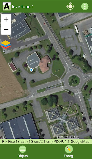
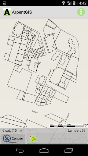
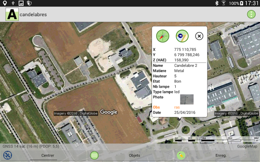
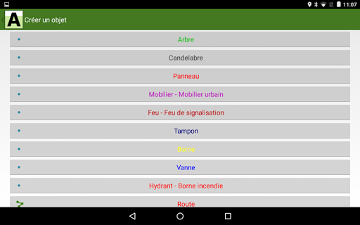
ArpentGIS is a mobile GIS software that allows you to map points, lines and areas by GPS from an Android tablet or smartphone.
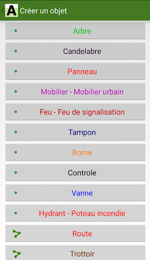
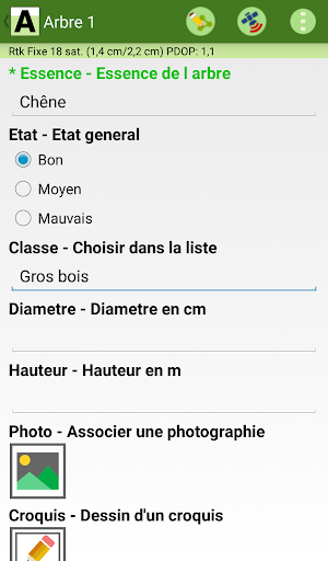
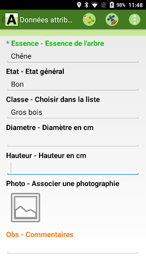
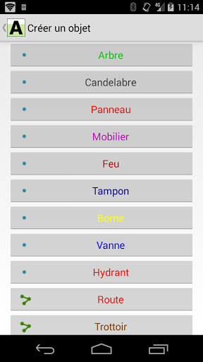
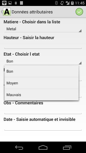
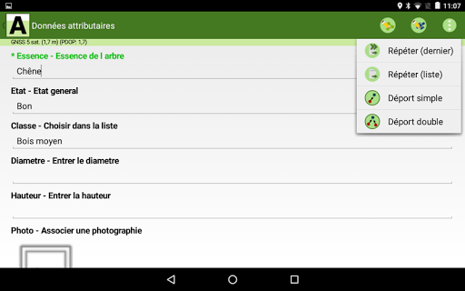
For each object saved the user can associate information (use of a customizable input form) such as comments, numerical values or values chosen from a drop-down list, photographs, sketches ...
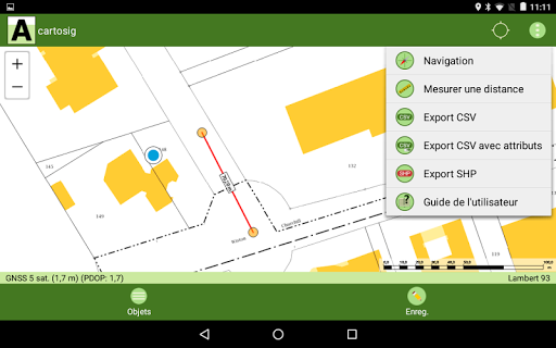
The data produced is in ArpentGIS AGI format and can be exported in SHP, DXF or CSV format. They are also directly usable by the PC software ArpentGIS-Expert and can be exported to any GIS software (ArcGIS, Mapinfo, QGIS, Geoconcept ...) or DAO (Autocad, MicroStation ...).
Main features:
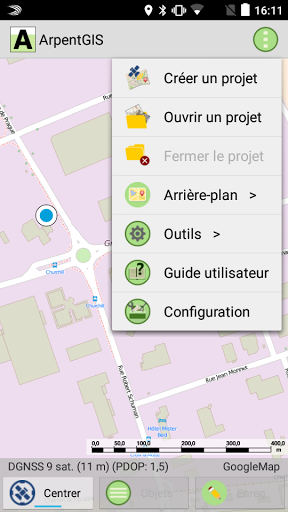
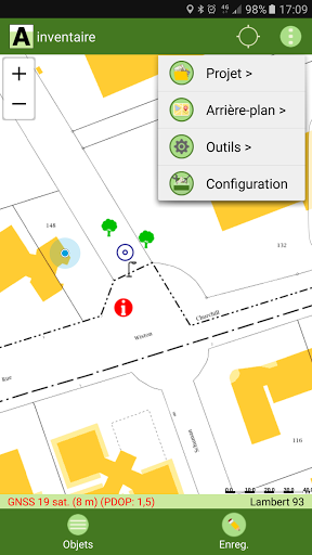
- Positioning of the user on a cartographic background
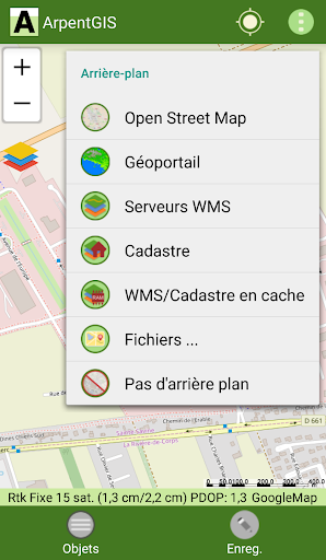
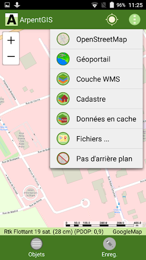
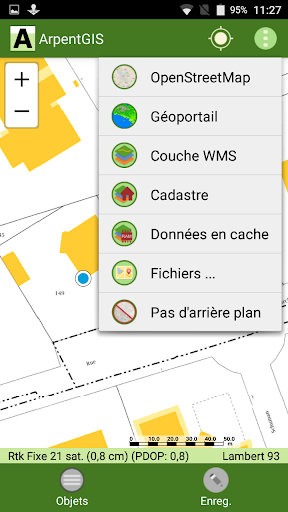
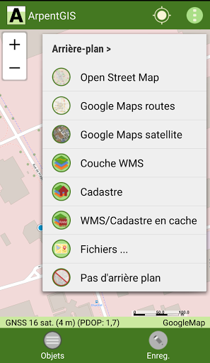
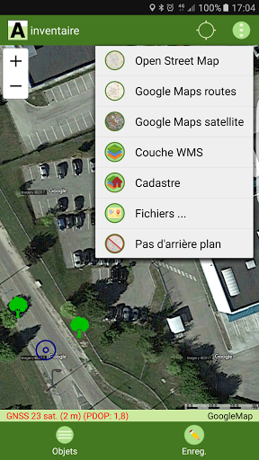
- Display of OpenStreetMap, Geoportal, Cadastre, WMS server backgrounds ...
- Display of raster backgrounds in TIFF, JPEG, JPEG2000 format
- Display of vector backgrounds in SHP, AGI, DXF, CSV, GeoJSON format and consultation of attributes
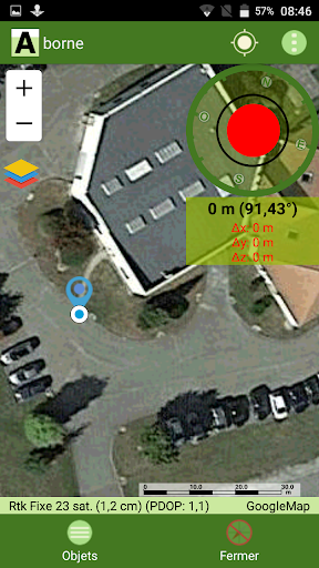
- Recording by GPS / GNSS of Points, Lines and Surfaces
- Average positions for Points and vertices for recording lines and areas
- Display and precision filter
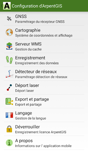
- Choice of coordinate system and geoids: Lambert 93, Conics conforming to 42 to 50, UTM, WGS84 ...
- Compatibility with internal GPS of smartphones / tablets
- Compatibility with external precision GNSS receivers (differential GNSS receivers and RTK) and Trimble Catalyst
- Use of customizable field entry forms
- Update of data in the field
- Layer manager with multi-queries on attribute data
- Data scanning on the card
- Navigation / Location of a point
- Configurable tracklog
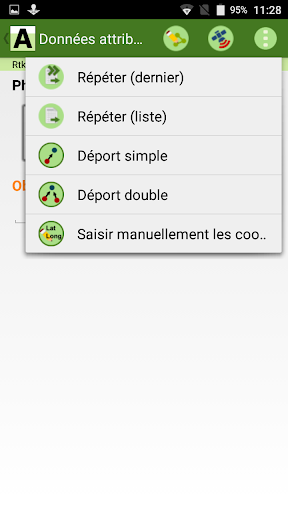
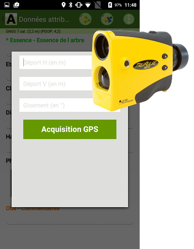
- Point capture by laser offset (TruPulse rangefinder), single or double offset
- Automatic recording and geolocation of data from a Radiodetection RD8100 detector for mapping buried networks ...
- Optimization of the application
- Utility for taking georeferenced photographs
- Improved support for files in DXF format
- Navigation: sorting targets by distance or name
- Lines and areas: possibility of setting the recording step in meters (via the field entry form)
- Moved the digitization button in the Options menu
- Compatibility with the new Radiodetection RD8200 network detector
- New stakeout tool from a CSV file
- Modification of the geometry of a line or surface
- Barcode and QR code reader
- Possibility of ending a line with an existing point
- Possibility of extending a line by defining a value in meters
- Ability to display a vertex of a line or surface to
stake out
- GeoJSON Export - Import Gas Tracker
- Precision sound alert
- Bug fixes and optimizations
Software optimized for the Trimble TD600 terminal
- New stakeout tool from a CSV file
- Modification of the geometry of a line or surface
- Barcode and QR code reader
- Possibility to end a line with an existing point
- Possibility to extend a line by defining a value in meters
- Possibility to display a vertex of a line or surface to
stake it out
- GeoJSON export - Import Gas Tracker
- Precision sound alert
- Bug fixes and optimizations
Main new features of ArpentGIS version 8:
- Import / Export of DXF files
- Queries on attribute data of SHP files
- Quick save button
- Import of files in GeoJson format
- Automatic creation of a line with a network detector
- New attributes checkbox, signature and sketch type
- "Close and Share" a Project function
- Management of vertical precision
- Optimization of the application
Main new features of ArpentGIS v8:
- Import / Export of DXF files (v.Pro)
- Queries on attribute data of SHP files
- Quick save button
- Import of GeoJson files
- Automatic creation of a line with a network detector
- Checkbox, signature and sketch type attributes
- "Close and Share" a Project function
- Management of vertical precision
- Optimization of the application
Main innovations ArpentGIS version 7:
- Support for JPEG 2000 format files
- Support for CSV files (implementation)
- Layer manager with multi-query filter
- Electronic bubble (Pro version)
- New navigation / implementation function
- Improved Geoportal display speed
- Trimble Catalyst Antenna: EVEREST technology addition, QZSS satellites
- Addition of the new geoid France raf18
- Software optimization and bug fixes
Main novelties:
- Support for JPEG 2000 format files
- Support for CSV files (implementation)
- Layer manager with multi-query filter
- Electronic bubble (Pro version)
- New navigation / implementation function
- Improved Geoportal display speed
- Trimble Catalyst Antenna: EVEREST technology addition, QZSS satellites
- Addition of the new geoid France raf18
- Software optimization and bug fixes
- Deleting Google Maps services
- Trimble Catalyst receiver: display of detail and number of satellites seen and used
- Filter on the search for coordinate systems
- Ability to display labels on the map
- Addition of additional information in the AGI file
- Compatibility with Trimble TDC150 and Trimble Nomad 5 GNSS receivers
- Performance optimization and bug fixes
- Ability to display the current GPS coordinates on the map (option to activate in the configuration)
- Application Optimization for Trimble Catalyst GNSS Receiver Usage
- Added access to IGN Geoportal in the menu "Background"
- Trimble Catalyst Update: Receiving GLONASS satellites
- New management interface for WMS servers
- Filter allowing to select the objects to display on the map
- "debug" window in network detection mode (verion Pro only)
- "About" window with links to the technical service
- Integration of the precise transformation grid for the old Lambert systems
- Link to view Trimble Catalyst information from the map
- Fixed WMS display problem
- Compatibility with Trimble Catalyst GNSS Receiver
- Compatibility with RD8000 PCMx Radiodetection Network Detector
- Supports GPX format for displaying backgrounds - QML file support for SHP background display configuration - Ability to import a WMS server list from a text file - Fixed cache access issues
- New display mode of the attributes - Offset and repetition of lines - Ability to continue a line with a laser - Automatic opening of backs related to a project - Sound alert when browsing - Selecting a point from the list of objects - Filter on the layers in the list of objects - Manual entry of coordinates of a point - Compatibility with the RD8000 PCMx - Compatibility with new Trimble Catalyst receiver
- Bluetooth recovery of measurements taken with a Trupulse laser range finder - Parameterizable tracklog - Taking into account the setting of the selective repetition of the attributes - Cache for WMS data and cadastre - Addition of a menu of choice of language: version available in French, English and Spanish - Optimization of the application

 Assistant AS-5434 Club


![icon Root/Super Su Checker Free [Root] for Assistant AS-5434 Club](https://img.apk.cafe/img:bz03cHN3ZjYmbD00NzgmaD1wbmcmZj1HbGk5MCZpPTA)


